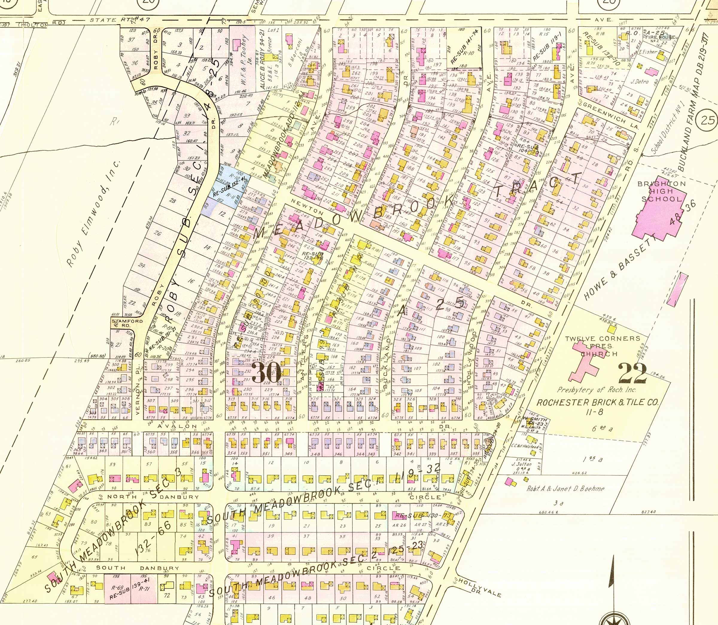
Meadowbrook Plat Map
Paul Bush, a long-time Meadowbrook resident, gave the association a beautiful plat map (survey map) that a friend came upon in an antique shop. It is an original D-size map (24″ x 36″), in color, in perfect condition, and now resides in our Meadowbrook Historian’s collection. It probably dates from the late 1950s — it shows a few empty lots on the loop connecting North and South Danbury.
The map shown below is scanned and cropped from that D-size map. Click here to download the full map. (2.5 MB PDF file)